
 PL
PL
 EN
EN
 DE
DE


Product Description
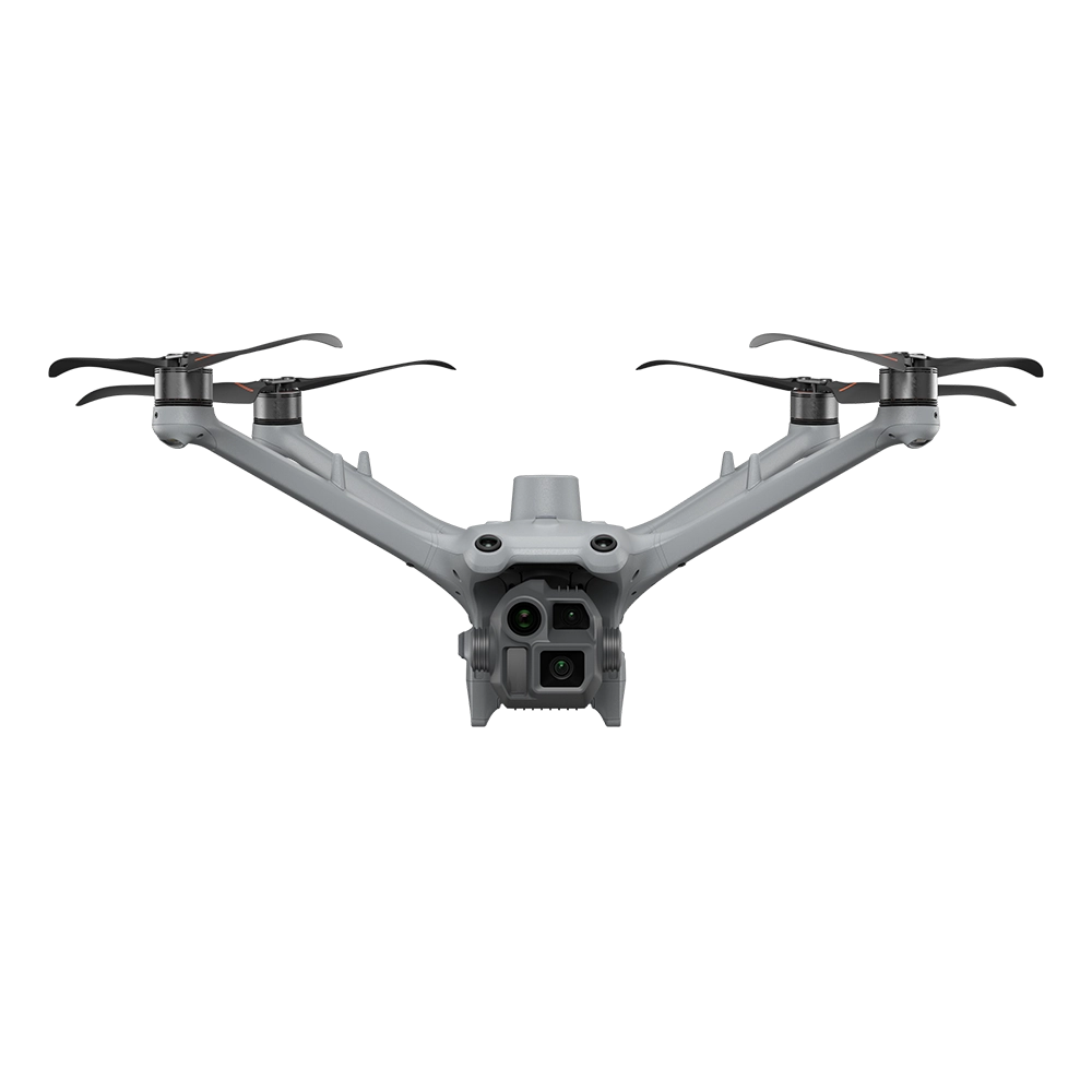
The DJI Matrice 4D is a professional drone for mapping and inspection, designed for manual operation with the DJI RC Plus 2 Enterprise and autonomous operation with the DJI Dock 3. The platform combines precise measurement sensors, an advanced camera system, and high environmental resistance — making it a complete tool for geodesy, energy, infrastructure, and BVLOS operations.
47 min
Max. flight time
15.5 km
O4+ Enterprise Range
IP55
Environmental resistance
C2 / C6
Operational class
Camera and Measurement System
The Matrice 4D is equipped with four independent imaging systems, which can be combined during a single mission — from precise mapping to detailed inspections from distances up to 250 meters.
| Wide-angle camera | 4/3" CMOS, 20 MP, f/2.8–f/11, 24 mm, mechanical shutter |
|---|---|
| Medium telephoto camera | 1/1.3" CMOS, 48 MP, f/2.8, 70 mm |
| Telephoto camera | 1/1.5" CMOS, 48 MP, f/2.8, 168 mm |
| Laser rangefinder | Up to 1800 m (1 Hz), accuracy ±(0.2 + 0.0015 × D) |
The wide-angle camera with a mechanical shutter eliminates the rolling shutter effect, ensuring sharp images even during fast flight — which is crucial for precise photogrammetry and corridor mapping.
Precise Mapping and Photogrammetry
The Matrice 4D supports advanced mapping mission modes, unavailable in standard platforms:
- 5-direction oblique photography — complete 3D models of buildings and infrastructure
- Orthophotomaps (3 directions) — precise maps of flat areas
- Real-time terrain following — constant altitude above the surface
In combination with DJI Terra and DJI FlightHub 2, the platform enables full mission automation and the creation of accurate 3D models directly after flight.
Autonomous Operations with DJI Dock 3
Compatibility with DJI Dock 3 transforms the Matrice 4D into an autonomous mapping and inspection system operating without operator intervention.
- Automatic take-offs, landings, and battery charging
- 24/7 BVLOS missions managed remotely
- Cyclic inspections and area monitoring
- Remote fleet management via DJI FlightHub 2
Range and Connectivity
The DJI O4+ Enterprise system provides stable HD image transmission up to 15.5 km. Support for the DJI Cellular Dongle 2 enables 4G connectivity, and the relay mode allows significantly increasing the operational range in hard-to-reach locations.
Obstacle Detection and Safety
The drone is equipped with an omnidirectional obstacle detection system. It can be further expanded with a LiDAR + mmWave module, which detects thin objects like wires with a diameter of 12 mm and ensures safe obstacle avoidance in conditions of limited visibility.
Precise RTK Positioning
The integrated RTK module works with the DJI D-RTK 3, providing centimeter-level measurement accuracy during mapping and infrastructure inspection.
Technical Specification
| Weight | 1850 g |
|---|---|
| Operational Class | C2 (RC Plus 2) / C6 (Dock 3) |
| Flight Time | Up to 47 minutes |
| Operational Range | Up to 15.5 km (O4+ Enterprise) |
| Max. Speed | 21 m/s |
| Wind Resistance | Up to 12 m/s |
| GNSS | GPS + Galileo + BeiDou + GLONASS + RTK |
| IP Rating | IP55 |
| Operating Temperature | -20°C to 50°C |
Battery
| Model | DJI Matrice 4D / 4TD Battery |
|---|---|
| Capacity | 6768 mAh |
| Voltage | 22.14 V |
| Energy | 149.9 Wh |
| Type | Li-ion 6S with self-heating system |
Kit Contents
| Drone | DJI Matrice 4D |
|---|---|
| Controller | DJI RC Plus 2 Enterprise |
| Power Adapter | DJI 240W Power Adapter |
| Charging Hub | DJI Matrice 4D Series 240W Charging Hub |
| Carrying Case | DJI Matrice 4D Carrying Case |
| Safety Module | DJI FTS Module |
Frequently Asked Questions
What is the difference between Matrice 4D and Matrice 4TD?
Matrice 4D is the version for mapping and daytime inspection — without a thermal camera. Matrice 4TD extends these capabilities with a 640×512 px thermal camera, enabling night work and detection of thermal anomalies. Both models have an identical flight platform and battery.
Does the Matrice 4D support autonomous missions without an operator?
Yes — in conjunction with the DJI Dock 3, the drone performs fully autonomous BVLOS missions in class C6, without the constant presence of an operator on-site. Missions are managed remotely via DJI FlightHub 2.
Does a mechanical shutter matter in mapping?
Yes — it eliminates the rolling shutter effect, which causes image distortion during fast flight. Thanks to this, orthophotomaps and 3D models created with Matrice 4D have higher geometric accuracy than those from drones without a mechanical shutter.
What software does the Matrice 4D work with?
Matrice 4D integrates with DJI Terra for photogrammetry and mapping, DJI FlightHub 2 for mission management, and external GIS and CAD platforms for further data analysis.