
 PL
PL
 EN
EN
 DE
DE


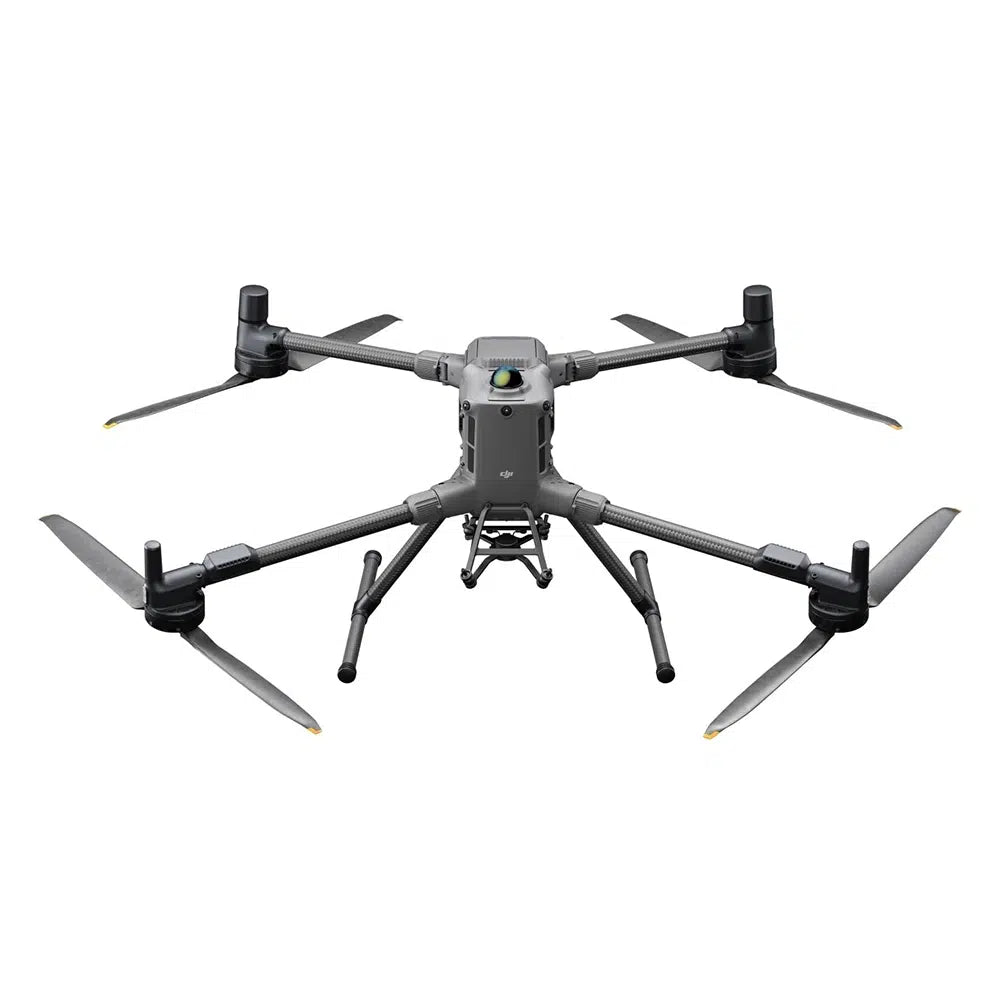
DJI Matrice 400 RTK – LiDAR kit (Zenmuse L3 + D-RTK 3)
Advanced new-generation UAV system for 3D scanning, surveying, and terrain analysis on the largest scale. The Zenmuse L3 scanner with a 1535 nm laser and dual 100 MP RGB cameras covers 10 km² in a single flight and up to 100 km² per day — with accuracy of 3 cm vertically at 120 m and 5 cm at 300 m. Exclusive to the DJI Matrice 400 platform.
100 km²/day
Daily Coverage (L3 + M400)
950 m
LiDAR Range @ 10% reflectivity
16 returns
Echoes per pulse (penetration)
3 cm / 5 cm
Accuracy V @ 120 m / 300 m
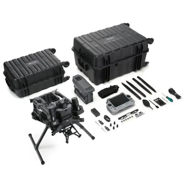
Kit Contents
- Drone DJI Matrice 400 RTK
- Battery DJI TB100 (977 Wh)
- Charging Station DJI BS100
- LiDAR DJI Zenmuse L3
- RTK Station DJI D-RTK 3
- Tripod & Pole Tripod & Stake D-RTK 3
Why is L3 the new LiDAR standard?
- 950 m range @ 10% reflectivity — over 2× more than L2
- 16 echo returns — deeper penetration of vegetation and denser structures
- Dual 100 MP RGB cameras, 107° FOV — photogrammetry and LiDAR in one flight
- 10 km² in one flight (300 m, 17 m/s) — fewer approaches, lower mission costs
- 3 cm GSD at 300 m — mapping-grade orthophoto data
- Adjustable pulse frequency 100 kHz – 2 MHz — optimization for various tasks
- 0.25 mrad beam divergence — 1/5 the spot size of L2, higher cloud resolution
- No IMU warm-up — immediate readiness after takeoff
DJI Zenmuse L3 – LiDAR System Specification
| Laser | 1535 nm, Class 1, adjustable frequency 100 kHz – 2 MHz |
|---|---|
| Scanning Range | 950 m @ 10% reflectivity, 100 kHz 700 m @ 10% reflectivity, 350 kHz 2000 m @ 80% reflectivity, 100 kHz |
| Number of Echo Returns | Up to 16 — best-in-class vegetation penetration |
| Beam Divergence | 0.25 mrad (1/e²) — 1/5 the spot size of L2 |
| Range Accuracy | 5 mm @ 150 m (1σ) |
| System Accuracy V/H @ 120 m | 3 cm / 4 cm (RMSE) |
| System Accuracy V/H @ 300 m | 5 cm / 7.5 cm (RMSE) |
| Coverage in one flight | Up to 10 km² @ 300 m, 17 m/s, 20% overlap |
| Daily Coverage | Up to 100 km² (6 h effective flight) |
| Scanning Modes | Linear, Star-Shaped, Non-Repetitive |
| RGB Cameras | 2× 4/3" CMOS, 100 MP, mechanical shutter 107° FOV (combined) |
| GSD (RGB) | 1.2 cm @ 120 m / 3 cm @ 300 m |
| Memory Card | CFexpress Type B, min. 1500 MB/s sequential write |
| Export Formats | LAS, LAZ, PLY, PCD, PNTS, S3MB |
| Compatibility | DJI Matrice 400 only |
| Protection | IP54 |
| Weight | 1.60 kg (without gimbal connector) |
DJI Matrice 400 – Platform Performance
- Flight Time: 59 minutes (flight) / 53 min (hover)
- Speed: up to 25 m/s
- Transmission Range: up to 40 km (FCC)
- Wind Resistance: 12 m/s
- Operating Altitude: up to 7000 m AMSL
- Weight with battery: 9.74 kg
Safety Systems
- 360° rotating LiDAR — 520,000 pts/s, detects 21.6 mm cables at 25 m/s
- 6-directional mmWave radar — detection in rain and darkness
- 360° vision system + Low-Light fisheye
- ADS-B In up to 20 km
Transmission and Connectivity
- O4 Enterprise Enhanced — 40 km (FCC)
- Built-in relay module
- Sub-2G + 4G (2× DJI Cellular Dongle 2)
M400 Technical Specification
| Weight (with TB100 battery) | 9740 ±40 g |
|---|---|
| Payload Capacity | Up to 6 kg |
| Max. Flight Time | 59 min (flight) / 53 min (hover) |
| Range (FCC / CE) | 40 km / 20 km |
| Protection Rating | IP55 |
| Operating Temperature | -20°C to +50°C |
| Battery | DJI TB100, 977 Wh |
| RTK | H: 1 cm + 1 ppm / V: 1.5 cm + 1 ppm |
FAQ
What is the main difference between L3 and L2?
L3 has over 2× greater range (950 vs. 450 m), 16 echo returns (vs. 5), two 100 MP RGB cameras (vs. one 20 MP), covers 10 km² in one flight (vs. approx. 2-3 km²), and has 5× smaller beam divergence. L3 is exclusive to M400, L2 also supports M300/M350.
Which applications prefer L3 over L2?
HV power line inspections from distances over 500 m, high-altitude mapping over 300 m, forestry requiring maximum vegetation penetration, large topographical projects (over 10 km² daily), and 100 MP class photogrammetry combined with LiDAR in a single flight.
What memory card does L3 require?
CFexpress Type B with a minimum sequential write speed of 1500 MB/s — high throughput required by dense LiDAR data and dual 100 MP cameras. This distinguishes L3 from L2 (microSD).
Is L3 compatible with M300/M350?
No — Zenmuse L3 is designed exclusively for DJI Matrice 400. For M300/M350, the Zenmuse L2 is dedicated.