
 PL
PL
 EN
EN
 DE
DE


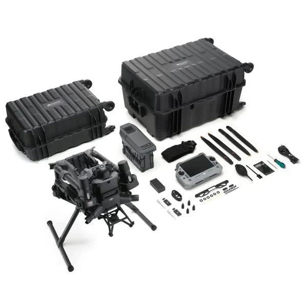
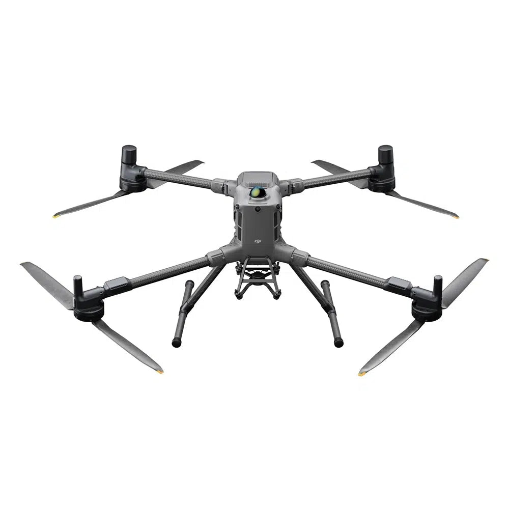
DJI Matrice 400 RTK – Photogrammetry Kit (Zenmuse P1 + D-RTK 3)
Complete UAV system for precise 3D mapping, surveying, and orthophoto generation. The Zenmuse P1 photogrammetry camera (45 MP full-frame, global shutter) with the M400 RTK platform and D-RTK 3 station — 3 cm horizontal / 5 cm vertical accuracy without GCPs (Ground Control Points).
3 km²
Coverage in one flight (P1)
3 cm / 5 cm
H/V accuracy without GCPs
0.7 s
Photo interval
59 min
Max. flight time M400
Kit contents
- ✔ DJI Matrice 400 RTK drone
- ✔ DJI TB100 battery (977 Wh)
- ✔ DJI BS100 charging station
- ✔ DJI Zenmuse P1 camera (45 MP full-frame, 35 mm lens included)
- ✔ DJI D-RTK 3 RTK station
- ✔ D-RTK 3 Tripod and Pole
Why is this kit ideal for photogrammetry?
- ✔ 45 MP full-frame camera — data quality unmatched by smaller sensors
- ✔ 1/2000 s global shutter — no rolling shutter effect, sharp images at high flight speeds
- ✔ 3 km² in one flight (at 3 cm GSD) — minimal number of passes
- ✔ RTK + D-RTK 3 — 3 cm H / 5 cm V accuracy without GCPs
- ✔ TimeSync 2.0 — camera/gimbal/FC/RTK synchronization at microsecond level
- ✔ Smart Oblique Capture — oblique and nadir images in one flight, +50% post-processing efficiency
- ✔ 59 minutes of flight time — large areas on a single charge
DJI Zenmuse P1 – the new standard for aerial photogrammetry
| Sensor | Full-frame, 35.9×24 mm, 45 MP, 4.4 μm pixel |
|---|---|
| Shutter | Global mechanical, 1/2000 s — no rolling shutter |
| Photo interval | 0.7 s |
| Coverage in one flight | 3 km² (at 3 cm GSD, 75%/55% overlap) |
| Accuracy without GCPs | 3 cm horizontal / 5 cm vertical |
| Lens (interchangeable) | 24 mm (FOV 84°) / 35 mm (FOV 63.5°) / 50 mm (FOV 46.8°) |
| TimeSync 2.0 | Microsecond-level synchronization |
| Smart Oblique Capture | Oblique and nadir images in one flight |
| Gimbal | 3-axis, ±0.01° stabilization |
| PPK | Yes — raw GNSS logs saved to card |
DJI D-RTK 3 – centimeter precision in the field
The D-RTK 3 station provides RTK corrections directly to the drone, eliminating the need for network service. Ideal for fieldwork without cellular network coverage, on construction sites, and in remote locations.
DJI Matrice 400 – platform performance
- flight time: 59 minutes (flight) / 53 min (hover)
- speed: up to 25 m/s
- transmission range: up to 40 km (FCC)
- wind resistance: 12 m/s
- max. altitude: 7000 m above sea level
- weight with battery: 9.74 kg
Safety systems
- 360° rotating LiDAR — 520,000 pts/s, detects 21.6 mm cables
- 6-directional mmWave radar
- 360° vision system + Low-Light fisheye
- ADS-B In up to 20 km
Transmission and connectivity
- O4 Enterprise Enhanced — 40 km (FCC)
- built-in relay module
- sub-2G + 4G (2× DJI Cellular Dongle 2)
M400 Technical Specifications
| Weight (with TB100 battery) | 9740 ±40 g |
|---|---|
| Payload capacity | Up to 6 kg |
| Max. flight time | 59 min (flight) / 53 min (hover) |
| Range (FCC / CE) | 40 km / 20 km |
| Protection rating | IP55 |
| Operating temperature | -20°C to +50°C |
| Battery | DJI TB100, 977 Wh |
| RTK | H: 1 cm + 1 ppm / V: 1.5 cm + 1 ppm |
FAQ
Are GCPs needed?
With the M400 + P1 + D-RTK 3 configuration, 3 cm horizontal / 5 cm vertical accuracy is achievable without GCPs. Control points can be used for higher accuracy or independent verification.
How large an area can be covered in one day?
With one set of batteries and a BS100 station, it's possible to cover over 7.5 km² per day. With two TB100 batteries in rotation — even more, without long charging breaks.
Which lens should I choose for P1?
24 mm lens (FOV 84°) — largest coverage, ideal for large areas. 35 mm lens (FOV 63.5°) — balance between coverage and detail, most commonly chosen. 50 mm lens (FOV 46.8°) — greatest detail, smaller coverage in one flight, for inspections.
Does the kit support PPK?
Yes — Zenmuse P1 records raw GNSS logs and TimeStamps.MRK on the SD card, ready for PPK post-processing in DJI Terra or other photogrammetry software.
Who is this kit for?
For surveyors, engineering firms, construction, mining, and anyone who needs precise 2D/3D spatial data from the air — especially where RTK network coverage is unavailable.