
 PL
PL
 EN
EN
 DE
DE

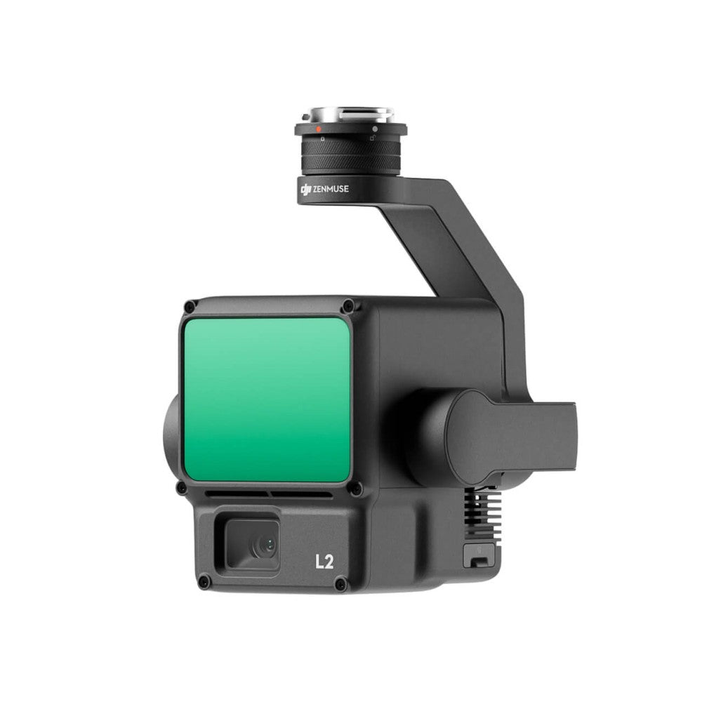
DJI Zenmuse L2 – system LiDAR + RGB (1,2 mln pkt/s, 450 m, 5 powrotów)
DJI Zenmuse L2 to system LiDAR klasy enterprise łączący skaner laserowy, kamerę mapującą RGB 4/3" 20 MP i precyzyjny IMU 200 Hz. Do 1,2 mln punktów na sekundę (multi-return), zasięg 450 m, 5 powrotów echa, dokładność 5 cm H / 4 cm V przy 150 m z RTK FIX. Brak rozgrzewania IMU — gotowość natychmiastowa.
1,2 mln pkt/s
Gęstość chmury (multi-return)
450 m
Zasięg (50% reflektywność)
5 cm / 4 cm
Dokładność H/V @ 150 m
5
Powrotów echa (penetracja)
Specyfikacja LiDAR
| Zasięg detekcji | 450 m @ 50% reflektywność, 0 klx 250 m @ 10% reflektywność, 100 klx |
|---|---|
| Dokładność systemu (RTK FIX) | H: 5 cm @ 150 m / V: 4 cm @ 150 m |
| Dokładność zasięgu (RMS) | 2 cm @ 150 m |
| Gęstość chmury punktów | Do 240 000 pkt/s (single) / do 1 200 000 pkt/s (multi) |
| Liczba powrotów | Do 5 (penta-return) |
| Tryby skanowania | Repetitive (70°×3°) / Non-repetitive (70°×75°) |
| Częstotliwość impulsów | 240 kHz |
| Długość fali | 905 nm, klasa 1 (IEC 60825-1:2014) |
| Kolorowanie chmury | RGB, reflektywność, wysokość, odległość |
System IMU i RTK
| Częstotliwość IMU | 200 Hz |
|---|---|
| Dokładność yaw | 0,2° (RT) / 0,05° (post-processing) |
| Dokładność pitch/roll | 0,05° (RT) / 0,025° (post-processing) |
| Pozycjonowanie RTK | H: 1 cm + 1 ppm / V: 1,5 cm + 1 ppm |
Kamera RGB
| Sensor | 4/3" CMOS, 20 MP |
|---|---|
| Ogniskowa | 24 mm (ekwiwalent) |
| Przysłona | f/2.8 – f/11 |
| Rozmiar zdjęć | 5280×3956 |
| Formaty | JPEG / DNG (RAW) |
| Wideo | 4K (3840×2160) @ 30 fps |
| Interwał | 0,7 s (min.) |
Specyfikacja ogólna
| Waga | 905 ±5 g |
|---|---|
| Wymiary | 155×128×176 mm |
| Gimbal | 3-osiowy, dokładność 0,01°, DJI SkyPort |
| Stopień ochrony | IP54 |
| Temperatura pracy | -20°C do +50°C |
| Nośnik danych | microSD, UHS-I, min. 50 MB/s, do 256 GB |
| Formaty eksportu | LAS, PLY, PCD, PNTS, S3MB |
| Oprogramowanie | DJI Terra |
| Kompatybilność | DJI Matrice 400, DJI Matrice 350 RTK, DJI Matrice 300 RTK |
Zawartość zestawu
| DJI Zenmuse L2 | × 1 |
|---|---|
| DJI Care Enterprise Basic | × 1 |
FAQ
Czy L2 penetruje gęstą roślinność?
Tak — 5 powrotów echa (penta-return) pozwala przejść przez warstwy koron drzew i zebrać punkty gruntowe pod roślinnością.
Czy wymagane jest rozgrzewanie IMU przed lotem?
Nie — L2 jest gotowy natychmiast po uzyskaniu RTK FIX. L1 wymagał 5–10 minut rozgrzewania.
Jakie oprogramowanie obsługuje L2?
DJI Terra — one-click processing, generowanie DEM, klasyfikacja gruntu. Eksport do LAS/PLY/PCD kompatybilny z ArcGIS, QGIS, CloudCompare i Terrasolid.